search
Map of Holy land in Jesus time
Map of the Holy land in the time of Jesus. Map of Holy land in Jesus time (Israel) to print. Map of Holy land in Jesus time (Israel) to download. Jerusalem at the time of Jesus was under Roman rule. The Roman occupation of Israel (63 BC.) was the last in a long line of invasions starting with the Assyrians and the Babylonians, then the Persians and the Greeks with Alexander the Great as its shown in the map of Holy land in Jesus time. By the time of Jesus birth, the Romans had established in Israel a system of government consisting of Roman overseers and local leaders who held and exercised power in the name of Rome. At the time of the birth of Jesus, the family of Herod the Great grew to prominence and the Romans made Herod to be king over Israel. He is known for his colossal building projects throughout Judea, including his expansion of the Second Temple in Jerusalem, called Herod's Temple.
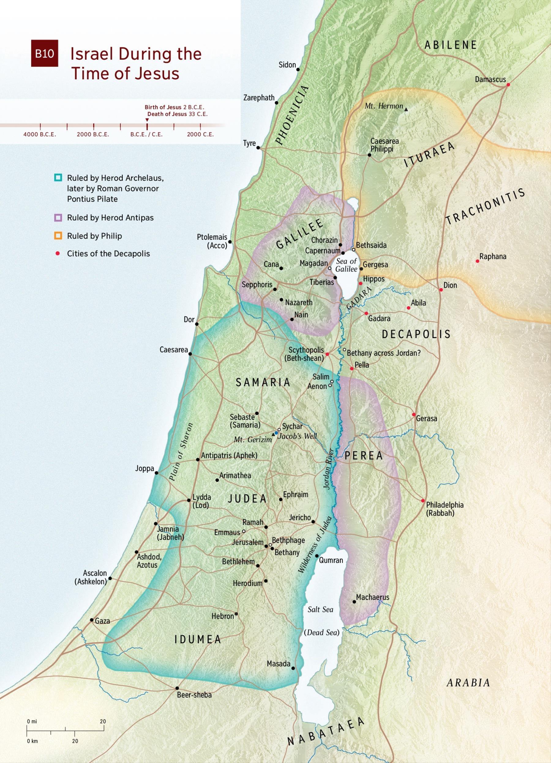
Although Jewish by religion and tradition, Herod and his family were Edomites and were hated by the Jewish people for their tyrannical rule. One of Herod sons, Archelaus, was so brutal in his exercise of power in Jerusalem, that Rome replaced him with one of its own governors, Pontius Pilate, who held office from 26 to 36 AD. Another of his sons, Herod Antipas, was responsible for the beheading of John the Baptist. Jesus was born in Bethlehem, but grew up in Nazareth, a small town within the province of Galilee, close to the larger metropolitan centers of Tiberias and Sepphoris as its mentioned in the map of Holy land in Jesus time. Jerusalem was the capital and the center of the Jewish world. The Jews were supposed to make a pilgrimage to the Jerusalem Temple for the three major Jewish Feasts of Pesach (Passover), Shavuot (Feast of Weeks) and Sukkot (Feast of Tabernacles).