search
Damascus gate Jerusalem map
Map of damascus gate Jerusalem. Damascus gate Jerusalem map (Israel) to print. Damascus gate Jerusalem map (Israel) to download. This is one of the most beautiful and impressive gates among the gates of the wall, which was built during the times of Sultan Suleiman the Magnificent from the 16th century. This is a central gate in the wall and it faces the north, towards Nablus and Damascus as its shown in damascus gate Jerusalem map. In English it is named Damascus Gate, and in Arabic- “Bab El Amud” (“the gate of the pillar”), probably due to the pillar that stood at the center of the gate courtyard during the Roman-Byzantine era, as evident in the Madaba Map, which was discovered in Jordan. Turban-like decorations decorate the gate, and due to its importance, many observations points and guard towers were built there. To this day, two main streets split from Damascus Gate, preserving the Roman structure of this area: the right street is the Khan A- Zeit or Beit Habad street, and the left street is El Wad Street- or Hagai.
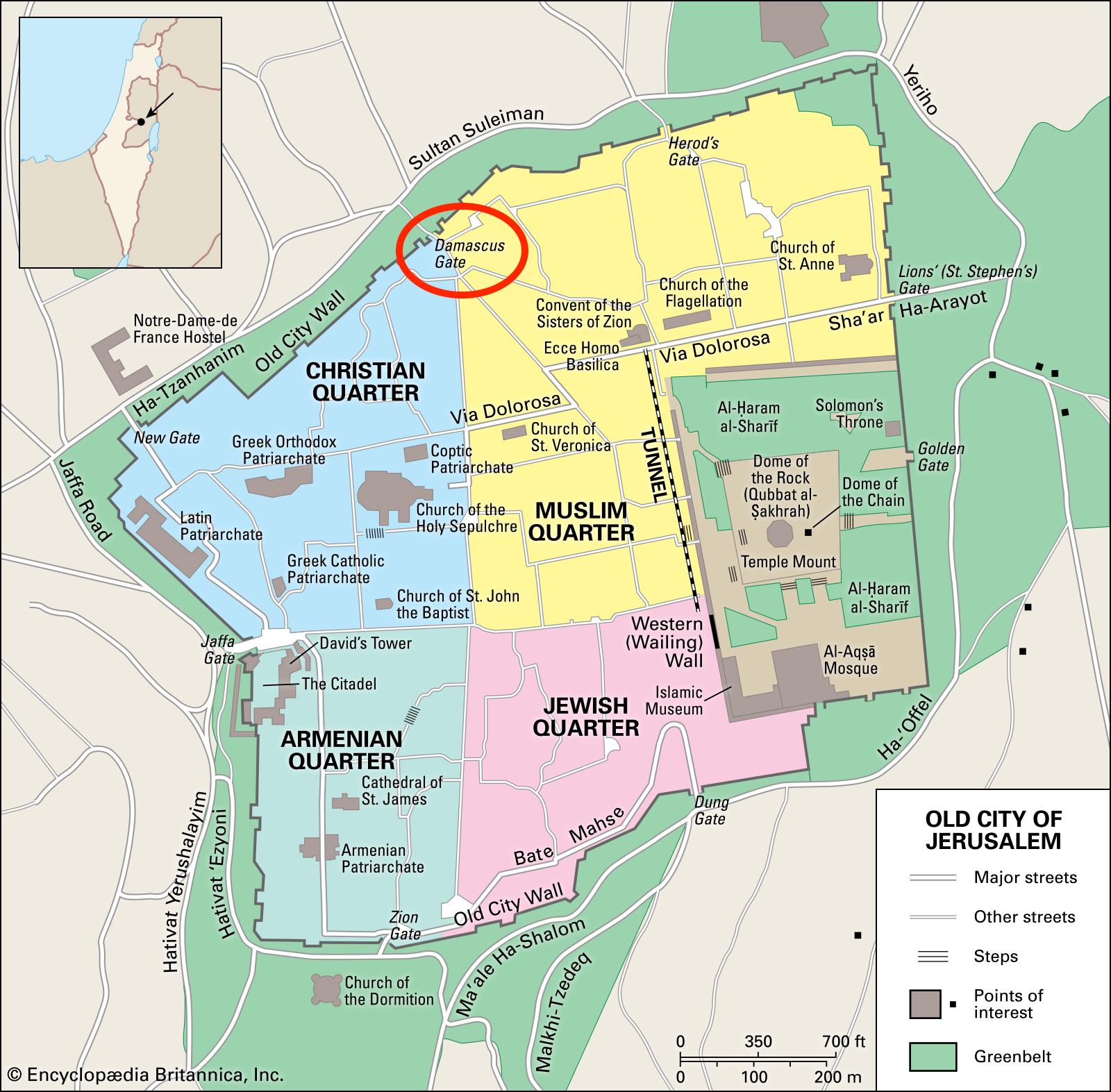
The sights and sounds of the Muslim Quarter intensify on the approach to Damascus Gate, on the northern wall of the Old City. The gate triangular crenellations give it the appearance of a crown; for the best view, walk through the gate to a small stone plaza, surveyed by armed Israeli soldiers, facing Derekh Shchem (Nablus) Rd as its mentioned in damascus gate Jerusalem map. The gate present form dates from the time of Suleiman the Magnificent, although there had been a gate here long before the arrival of the Turks. This was the main entrance to the city as early as the time of Agrippa, who ruled in the 1st century BCE. The gate was considerably enlarged during the reign of the Roman emperor Hadrian. Excavations in the 1960s revealed the remains of a triple-arched Roman gate.